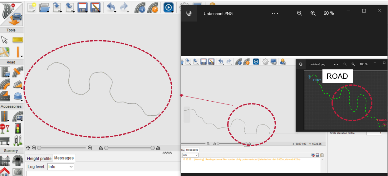
Hello, I have a route in .dig file format that is about 70 kilometers long and I want to load it in the scenario editor. When doing so, I have some problems, as some curves are not drawn correctly and a straight route is displayed instead. In addition, I get the error message ‘[Warning] External file is being read - number of dig. Points reduced (detected minimum, distance 0.002m, allowed 0.25 m)’. Although my X-axis advances in steps of ~ 0.1 and my Y-axis advances in steps of ~ 0.5. Oddly enough, this problem does not happen when I load only part of these curves. Is there any way to solve this problem?
Thank you in advance.
Good morning,
Thanks, it is very accurate description.
Which CM version are you using?
can you please share the file here?
Thanks
Roberto