Hi!
I got a track mapped by GPS data. Although the starting point and end point are equal, I am not able to run multiple laps as the angles are not equal which means that there is a very sharp bend which causes the simulation to end. Funnily this does not trigger a fault in the session log but says SIM_END although the end condition is not fulfilled
So the question now is, how do I set the angles of start and end point correctly so that they are in one line? There is a setting in the scenario editor (start angle and end angle) but the end angle is not changeable by the user. It rotates when I change the start angle which causes the whole track to rotate.
Would it posible for you to upload your .rd5 file here and maybe also some pictures? You could also upload a simplified or similar .rd5 file
As said in the title, it is a .kml file. This file type is unfortunately not authorized for upload here. But I uploaded it here if thats good enough for you:
https://file.io/DWCQexL62UzA
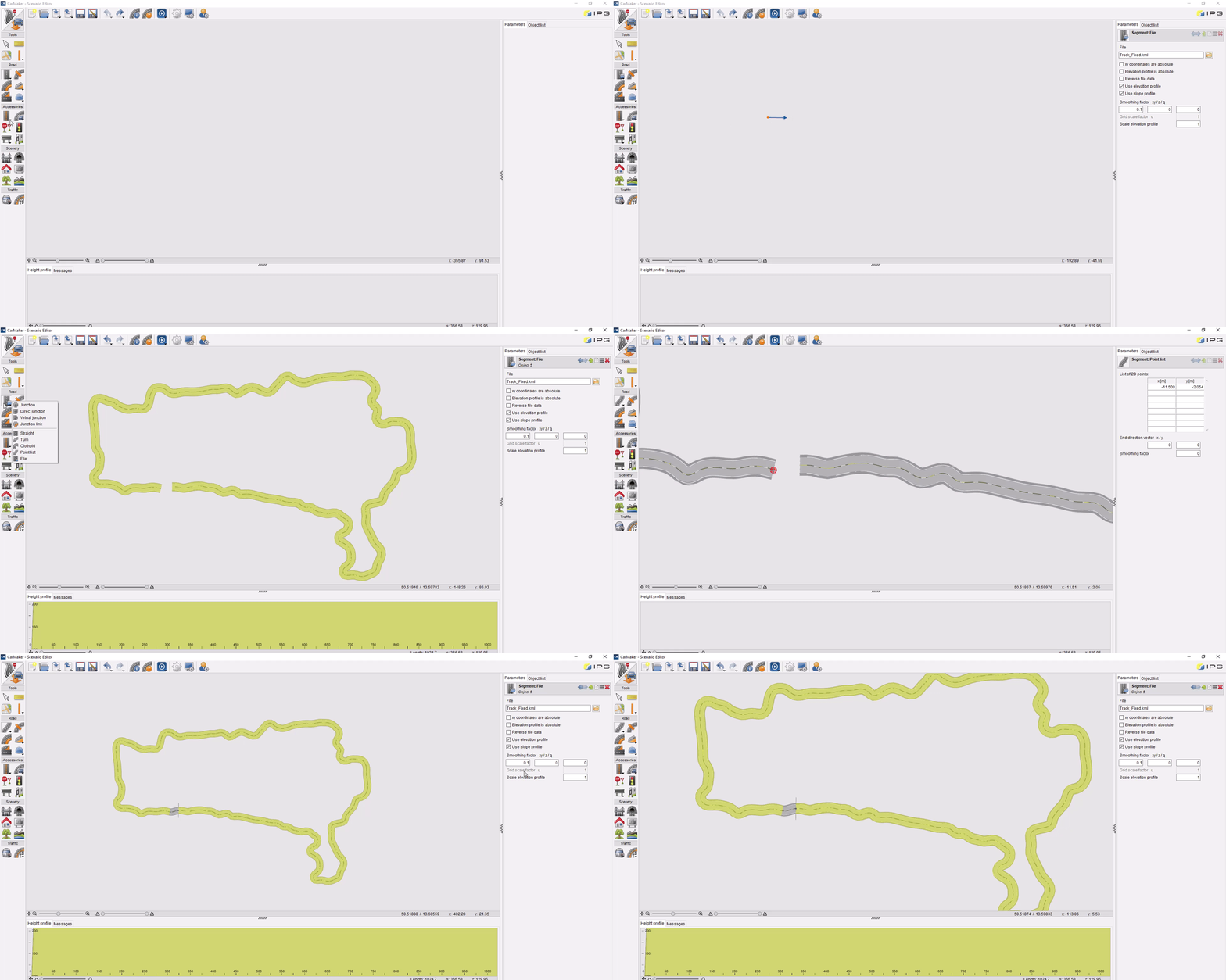
I’ve now enabled the upload of .kml files. Attached is your original .kml file, along with a modified version where I’ve removed the last point to prevent overlap. You can now connect the two ends with a point list, which will automatically close the loop with a direct junction.
Track.kml (4.8 KB)
Track_Fixed.kml (4.8 KB)
Take a look at the gif that illustrates how to do it. Make sure to adjust the soothing factor of xy and z.

I see, thank you very much! That solved the issue!
